By the AgWeb.com editors
It’s been the talk of the coffee shop – scientists have been forecasting the development of El Niño for months and issued the first El Niño Watch on April 13. In the National Oceanic and Atmospheric Administration’s monthly outlook released on Thursday, forecasters issued an El Niño Advisory, meaning El Niño conditions are now present and expected to gradually strengthen into the winter.
WHAT IS EL NIÑO?
El Niño is associated with a band of warm ocean water that develops near the equator in the central and eastern Pacific Ocean, but the impacts on the climate extend far beyond. The natural climate phenomenon occurs on average every two to seven years.
“Depending on its strength, El Niño can cause a range of impacts, such as increasing the risk of heavy rainfall and droughts in certain locations around the world,” says Michelle L’Heureux, climate scientist at the Climate Prediction Center. “Climate change can exacerbate or mitigate certain impacts related to El Niño . For example, El Niño could lead to new records for temperatures, particularly in areas that already experience above-average temperatures during El Niño.”
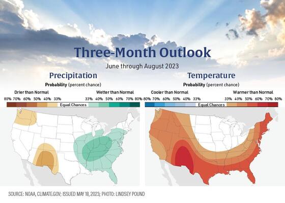
El Niño’s influence on the U.S. is expected to be weak during the summer months and then become more pronounced in late fall through spring. By winter, there is an 84% chance of greater than a moderate strength El Niño, and a 56% chance of a strong El Niño developing.
Typically, moderate to strong El Niño conditions during the fall and winter result in wetter-than-average conditions from southern California up the Gulf Coast and drier-than-average conditions in the Pacific Northwest and Ohio Valley. El Niño winters also bring better chances for warmer-than-average temperatures across the northern tier of the country.
While most headlines highlight how El Niño can bring historic heat around the globe, agricultural meteorologist Eric Snodgrass says it also tends to bring favorable growing conditions for crops in the Midwest.
To read entire report, Click Here

